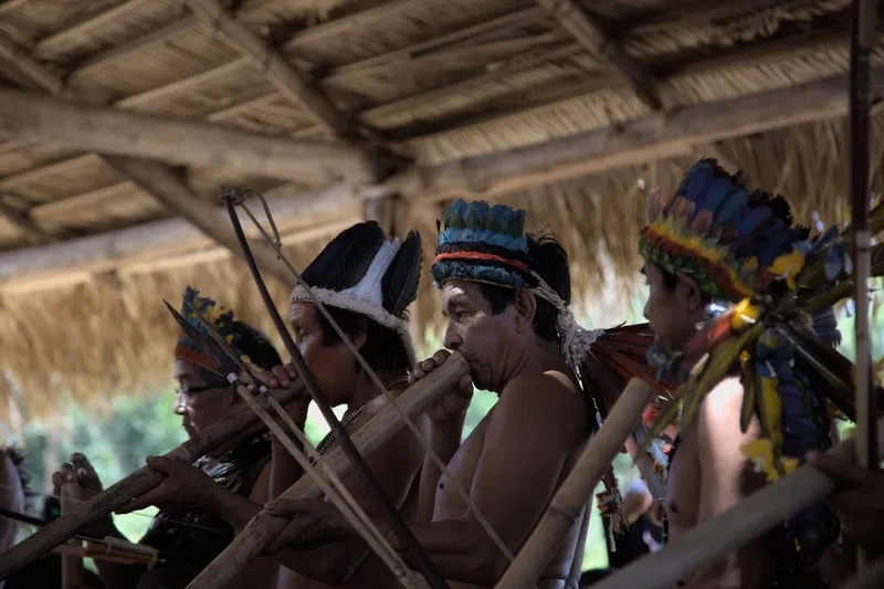
Once a year, dozens of indigenous people from the Tenharim Marmelos Indigenous Land (IL), in the municipalities of Humaitá and Manicoré, Amazonas state, leave their villages on an expedition towards the southern end of their territory, where the headwaters of the Branco, Preto and Marmelos rivers are located.
The group spends up to 20 days in the forest and returns with game and fish that provide food for all participants of the Mbotawa festival, held in July. The celebration gathers the population of the eleven villages in the territory, as well as guests from other indigenous groups of the Kawahiva branch.
Up to 500 people take part in the festival to experience, together, the rites of the Tenharim – weddings; the ritual of young women, which marks young Indigenous women’s passage into adulthood; and the ritual of the dead, in which the memory of the deceased is revered.
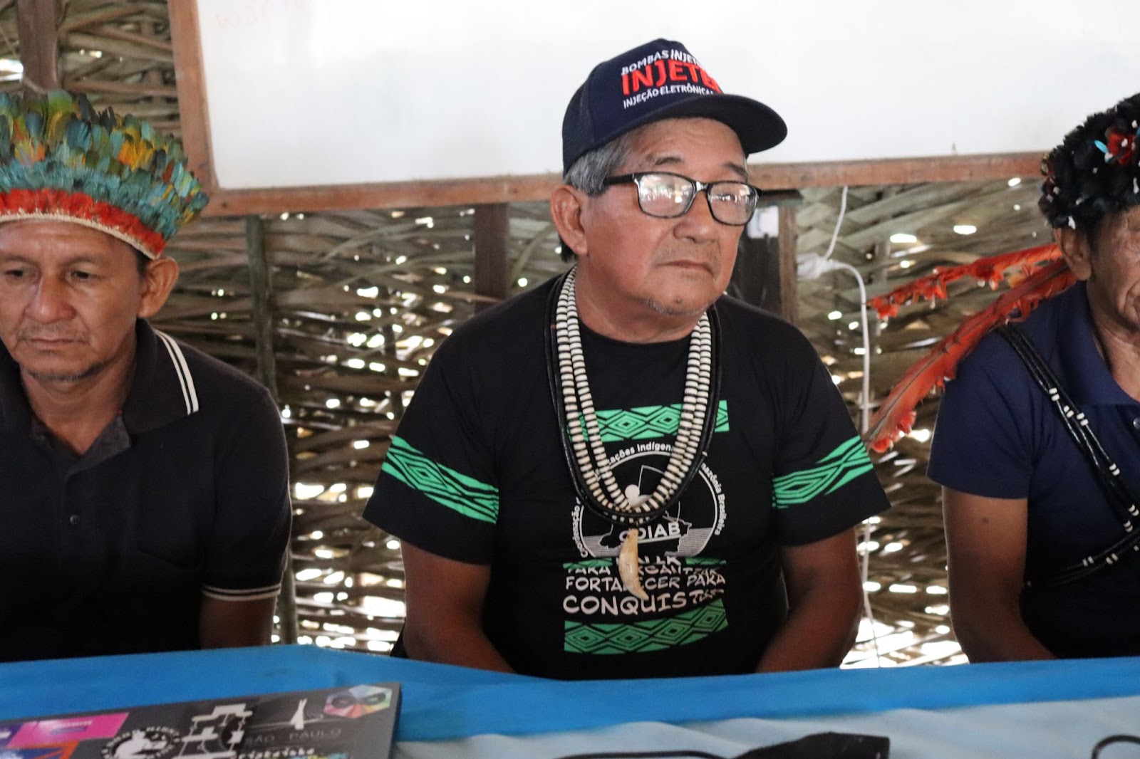
“When we organize this party, we involve the entire territory. Women, children, young people and the elderly. It is a time for older people to pass on traditional knowledge, our culture and traditions to youth,” explains Daiane Tenharim, head of the Tenharim Morõgwitá Indigenous People Association (Apitem).
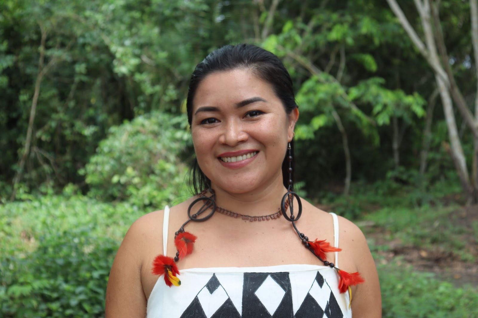
Daiane Tenharim, head of the Tenharim Morõgwitá Indigenous People Association (Apitem) Photo: Eduardo Passaro/IIEB
The expedition goes to the most preserved part of the territory, which the Indigenous people call “the market.” They do not hunt or fish in that area during the year, precisely to have a “stock” to which they can resort for the July festival. The area has been inhabited by the Tenharim since before they had contact with non-indigenous people. It is the site of the ancient village Aeguera, after which a stream connected to the Preto River is named.
Being an area of virgin forest, isolated indigenous groups also circulate there, recognized as Kawahiva relatives by the Tenharim. They are identified by the National Foundation of Indigenous Peoples (FUNAI) as the Kaidjuwa isolated group, but their registration has not yet been confirmed by the General Coordination of Isolated and Newly Contacted Indians (CGIIRC), a FUNAI branch. That is what effectively guarantees the measures to protect their circulation area, since confirmation suspends all economic activities as well as contact with non-Indigenous people by restricting use of the area.
It is also in that area that the construction of the Tabajara Dam is planned, a 37-square mile (97-sq. km) reservoir in Machadinho d’Oeste, Rondônia state. The project has been under discussion for 17 years and, as revealed by InfoAmazonia and Brasil de Fato, it should reach nine Indigenous lands (ILs), including isolated peoples. The Tenharim Marmelos is the closest IL to the project.
The first Environmental Impact Assessments (EIA) for the Tabajara Dam already predicted that the area impacted by the project would include the Tenharim Marmelos IL. In addition to the population estimated at 1,134 indigenous people in the two demarcated areas, the territory has evidence of the presence of isolated peoples, is considered sacred by the Tenharim, and is located approximately 650 feet (200 m) from the reservoir.
The southern part of the IL, closest to the proposed dam and called Piraquara by the Tenharim, is a nursery where fish reproduce. “It’s very close to the Machado River [also known as Jiparaná], right at the head of the Preto River, and we take great care of that area throughout the year and during our entire existence because they reproduce there,” explains Daiane Tenharim.
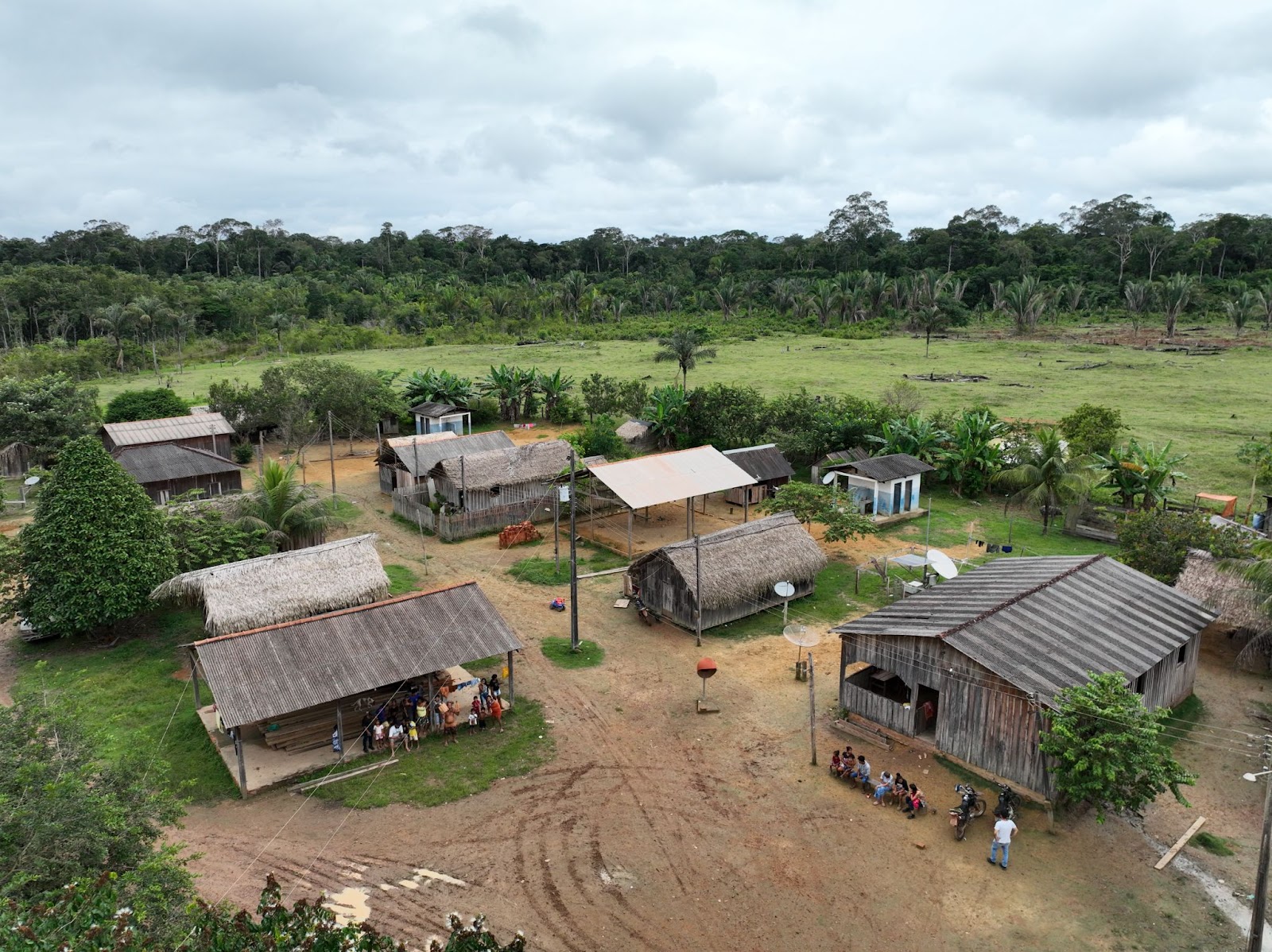 Aerial view of the village in the Tenharim Marmelos IL. Photo: Eduardo Passaro/IIEB
This part of the territory is preserved by the indigenous population for fishing and hunting during the MBotawa festival, but it is also the place of ancient villages and cemeteries. Before contact with non-Indigenous people, the Tenharim used to bury their loved ones inside their own homes.
“We have a very strong connection with our ancestors, those who have passed away. Just by thinking that all that may go underwater, that everything will be flooded, we feel sad and disgusted,” says Daiane Tenharim.
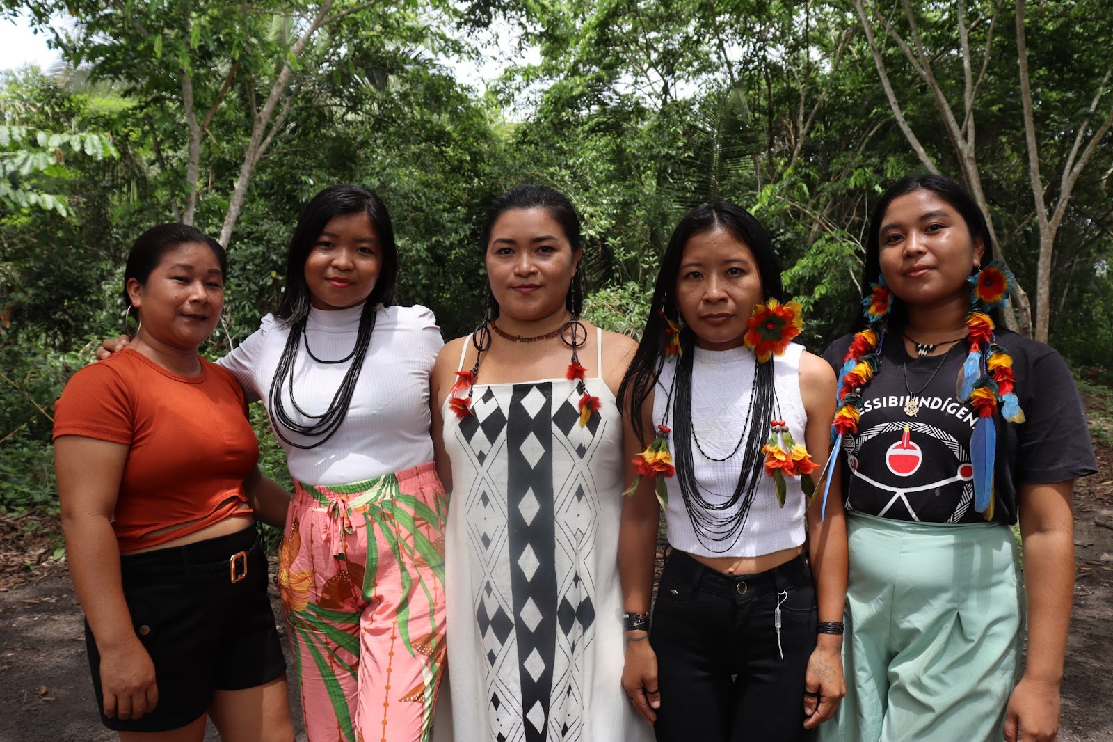 Daiane Tenharim (center) with a team of indigenous women from Apitem. Photo: Eduardo Passaro/IIEB
The Tenharim even met with staff of the company hired to conduct the EIA for the Tabajara Dam – JPG – and they helped the researchers collect information about the territory. The indigenous people showed the places considered sacred as well as the areas where they extract Brazilian nuts, açaí palm berry and diesel tree oil. Daiane says that the information provided by the Tenharim was ignored in the assessment.
“We had such a bad feeling of neglect, of total disrespect towards our people, our ancestry, our ancestors, our territory. Nothing was included, and we saw that the report was a sham. They only showed the positive side to benefit the company but not the negative side of the impact we’ll bear.”
The reporters traveled along a stretch of the Marmelos River accompanied by Tenharim environmental agents to the Paricá waterfall, where indigenous people do extractive activities, hunting and fishing. That waterfall also dates back to the time of their contact with non-indigenous people. In the 1940s, during the era of the barter activity known as regatões, a large trading warehouse was established near the waterfall. Since it was far from the villages’ location at that time, it enabled a friendly relationship between the Indigenous people and the traders.
From the Paricá waterfall, the reporters went north through the Marmelos River and reached the point where it joins the Preto River, which the indigenous people use during the hunting and fishing period for the traditional festival. That is where the Tenharim’s Brazil nut groves are located. In addition to being part of their diet, the nuts are also an important source of income for the territory’s residents.
“The nuts are sold and they benefit many families, just like fish, which is also part of our daily lives and everyone’s diet,” says Daiane Tenharim.
These areas of the territory used to sustain the villages and their culture, which were ignored in the Tabajara Dam’s EIA, continue to be mapped by the Tenharim themselves. Indigenous environmental agents are in charge of monitoring the territory in communication with the elders and using geographic information systems (GIS) and geoprocessing techniques, and they began to record these points on an updated database.
Ancient knowledge of important references for Tenharim culture is passed on by older to younger indigenous people, who used an app to record the geographic coordinates during monitoring expeditions. “This brings all information together and makes it easier for other environmental agents and for our people, by providing them with this information in different and technology-based ways,” says Ivanise Tenharim, an environmental agent who lives in the Marmelos village and accompanied the reporters in their journey along the river.
During the period in which InfoAmazonia and Brasil de Fato were at the Tenharim Marmelos Indigenous Land, Ivanise was working on a map with the important areas – crops, fishing, nut collection, etc., which provide benefits to the Indigenous people. She shared coordinates of some of these points, located along the river, which demonstrate the importance of people’s relations with the waters that cross their territory. Areas used for hunting, nut collection, and crops feed this geographic database.
The dispersal of Kagwahiva groups
The contact of the Tenharim with non-indigenous people dates back to Brazil’s so-called rubber cycle in the 1940s, including the construction of the Trans-Amazonian Road (known as BR-230), opened in 1974, and the mining activity that followed it. These were traumatic processes marked by extreme violence, deaths and the dispersal of some groups that began to live in isolation.
 Aerial images of the Trans-Amazonian Highway. Photos: Eduardo Passaro/IIEB
According to the stories told by the Tenharim to the reporters, the construction of the road would have caused the main impact on their territory and culture. Known in Tenharim language as pepuku’hua, or “long path,” the Trans-Amazonian Road marks the presence of non-Indigenous people in the region inhabited by the Kagwahiva.
“Many families lost their mother tongue because they had a lot of direct contact with non-indigenous people, since they worked in the construction site. And then they ended up forgetting how we say our things, our way of life. A lot of things changed after the Trans-Amazonian crossed this place,” says Daiane Tenharim.
Anthropologist Karen Shiratori describes this process as “some sort of end of the world” for Kagwahiva groups. “It was the end of a world as it existed until the Trans-Amazonian Road was opened, when those ties were permanently broken. When some areas can be preserved as refuges where people can stay away and refuse contact, that’s the resistance strategy chosen by many indigenous peoples who prefer to stay in isolation, break up social, kinship, ritual and ecological relations with that territory, and move away.”
The diseases brought by around 3,500 construction workers led to massive deaths of Indigenous people. “When we look at our people at the time of that tragedy that left people dead, counting several bodies without being able to do anything, that’s very hard for us, it’s hard to forget and it’s hard to forgive the Brazilian State,” says Mrs. Margarida, one of the elders of the group who spoke to the reporters alongside her husband, João Bosco, who is chief of the Mafuí village.
When he was around 12, João Bosco was ordered to carry food and bring coffee to the construction workers, without being paid for it. “I was forced to do that, to work as a slave. It wasn’t just me; most of the Tenharim were enslaved. The Paranapanema company that opened this road enslaved many of our relatives to work without pay, and they used many Tenharim,” he says.
João Bosco, chief of the Mafuí village (center). Photo: Eduardo Passaro/IIEB
Paranapanema was hired by governments during the military dictatorship (1964-1985) from 1970 onwards to build the last section of the Trans-Amazonian Road, which goes from the banks of the Marmelos River to the vicinity of the Aripuanã River. The company opened a cassiterite mining site near the Igarapé Preto Indigenous Land, where it remained until 1987.
For the Tenharim, who experienced this process for more than 40 years, the news of the construction of a dam near their territory was a cause for concern.
“The land is us; we are connected to it and it is connected to us. So we already have this experience. When we heard about this Tabajara Dam project, it became clear that what will happen is much worse than what happened with this (Trans-Amazonian) road, once again,” Margarida Tenharim points out.
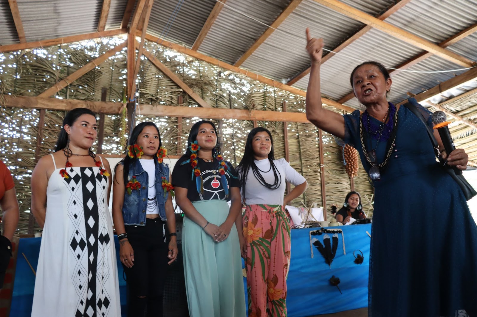 Margarida Tenharim holding a microphone during the Environmental and Territorial Management Plan (PGTA) validation session at the Tenharim Marmelos IL. Photo: Eduardo Passaro/IIEB
“It will kill everything that lives in that forest. Pigs, tapirs, monkeys, they’ll all die. The forest, which is nature, collects water as it is used to. But if the water goes beyond that level, which it has never seen, the trees die, and the fruit. How will animals live? And what about us, with our food, that is, game and fish?”, asks Manoel Duca Tenharim, chief of the Bela Vista village.
“It’ll harm the fish, it’ll poison all the fish. Game will also disappear, many things in the environment, the fruit we eat, which are part of our habits. Our reserve, our forest, which is healthy for us. So we feel lots of fear and concern for our territory,” points out chief João Bosco Tenharim.
The Tenharim people demand consultation
In December 2023, after InfoAmazonia and Brasil de Fato visited the territory, the Tenharim approved their consultation protocol. It focuses on projects that affect their territory as established in Convention 169 of the International Labor Organization (ILO), which is legally binding and is the only global agreement that addresses the rights of around 370 million indigenous people spread over more than 70 countries.
According to the Convention, Indigenous consultation must follow the procedures defined by the communities themselves in their protocols, if they exist, and must be free from external interference, take place before any agreement is signed, and be widely disclosed to the entire community in the territory.
“We organized internally to devise strategies to face this project so that everything that happened with the opening of the Trans-Amazonian Road would not happen again – our relatives would not be enslaved, women would not be raped, and we wouldn’t lose this way of being, our identity and this way of life of the Tenharim people,” Daiane Tenharim points out.
The International Institute of Brazilian Studies (IEB) works to prepare consultation protocols across the entire block of Indigenous lands that a Federal Court ordered to be included in the Tabajara Dam studies. According to Marcela Menezes from the coordination of the IEB’s Indigenous Peoples Program, the dam must be seen within a larger context of several projects linked mainly to agricultural expansion that also affect these Kagwahiva territories, such as the paving of the BR-319 road, whose impact is combined with the Trans-Amazonian road.
Along the stretch of BR-319 that connects Porto Velho, Rondônia to Humaitá, Amazonas, the expansion of farms to produce commodities such as soybeans and rice can already be seen. “This happens because Humaitá is a ring road; it has a road that passes outside the city and is connected to a large bulk grain port where barges can operate. This has greatly increased the circulation of trucks, of transportation,” Menezes points out.
Between 2008 and 2023, the Marmelos Indigenous Land saw 10,4 square miles (26.95 sq. km) of deforestation considering the two portions of the demarcated territory, according to data from the National Institute for Space Research’s (INPE) Prodes monitoring system.
If we consider a 6-mile (10-km) belt around the territory to assess external impacts that approach the Indigenous Land, deforestation in the same period was 180,69 square miles (467.98 sq. km). Around the demarcated territory, it restricts fishing and hunting to more preserved areas, says Daiane Tenharim. “We already feel the scarcity of food, fish, game. And we are very worried, because it’s a cultural impact that, when it happens, we can’t recover.”
Ivaneide Bandeira Cardoso, aka Neidinha Suruí, is a founder of the Kanindé Association for Ethno-environmental Protection, based in Rondônia’s state capital Porto Velho. She points out that the construction of the Tabajara Dam will be another source of pressure to advance deforestation in the Amacro area of the Brazilian Amazon, which includes the states of Amazonas, Acre and Rondônia.
“Land grabbing and deforestation have increased in these areas. You already have a lot of pressure with the BR-319 road paving project, and then what’s happened with BR-364 will happen again – that is, a fishbone [open branches along the highway], which led to a huge increase in deforestation in that area. The same is happening in southern Amazonas state with the Trans-Amazonian, the BR-319 road, and the Tabajara Dam project.”
At the request of the Federal Prosecution Service (MPF), te Research Group on Geography and Spatial Planning in the Amazon (GOT-Amazônia) of the Federal University of Rondônia (UNIR) conducted studies about the impacts of the Tabajara Dam. The group’s coordinator Madalena Cavalcante points out that the EIA must predict potential impacts of the construction work on the Indigenous territory over time. She says that the area is already facing the first stage of the project’s impact.
“Even before this project materializes, we are already in the first stage, which is the speculative impact that is affecting local populations, creating uncertainty. In the economic domain, there might be exploitation in terms of employment, which can attract populations. Speculation changes the entire real state dynamics for land and houses. In other words, there’s already an impact as a result of uncertainty and speculation,” Cavalcante says.
A second stage occurs after the license is granted to start construction, with the immediate impacts caused when construction starts. “People have to be displaced from the area for construction and later, the populations around the reservoir have also to be displaced, and forest vegetation must be removed.”
The last stage of the project’s impacts begins with its operation, according to Cavalcante. “These are operational impacts, because, even after construction is finished, we don’t know the effects on the dynamics of fish, for example; we don’t have a date for this to end.”
This story is the result of training carried out by InfoAmazonia as part of the Together for Conservation project, implemented by Internews in alliance with USAID and WCS. The content is under the responsibility of InfoAmazonia and Internews and does not necessarily reflect the views of WCS, USAID, or the United States government.